Land Surveying
61 items found
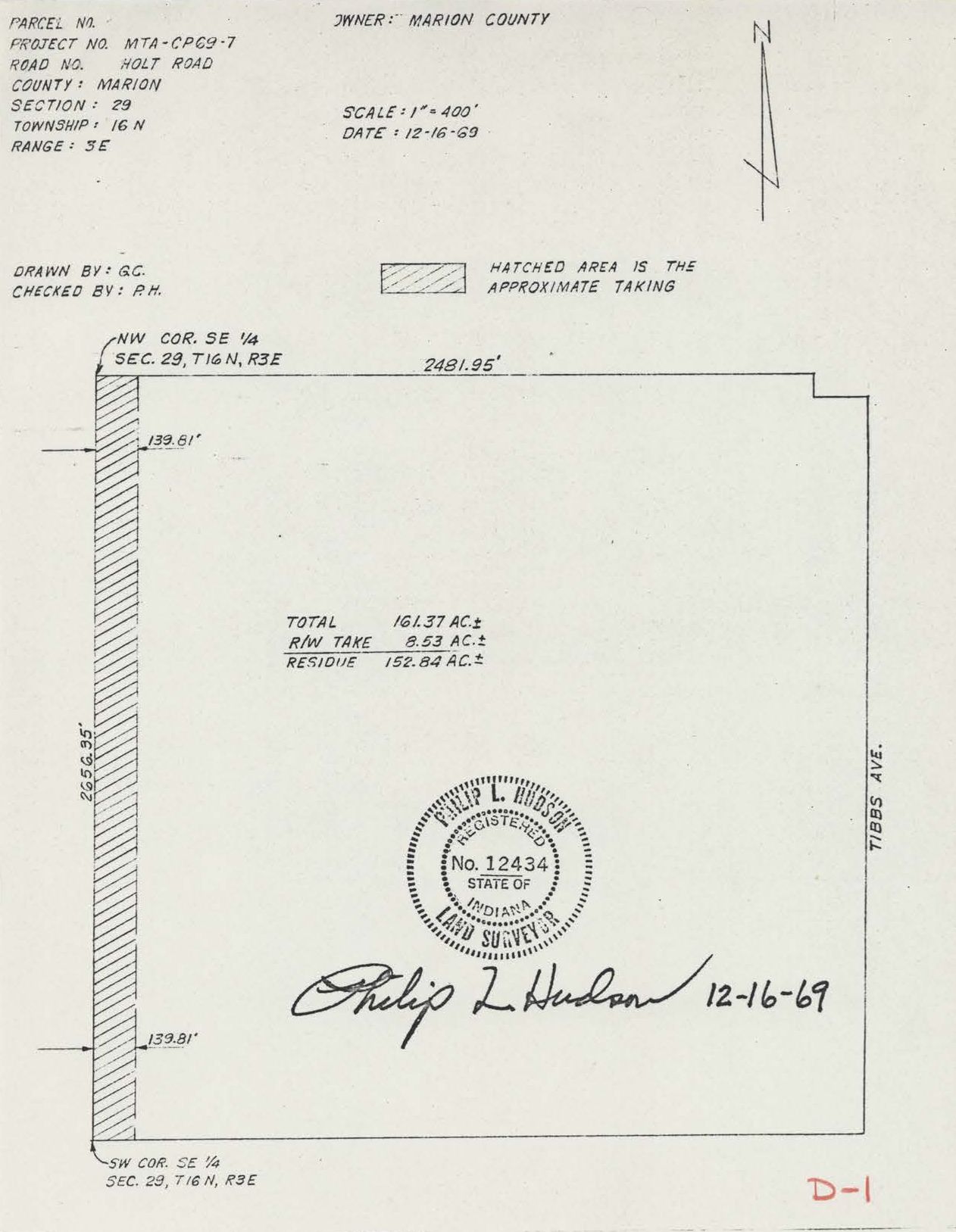
Land Survey drawing
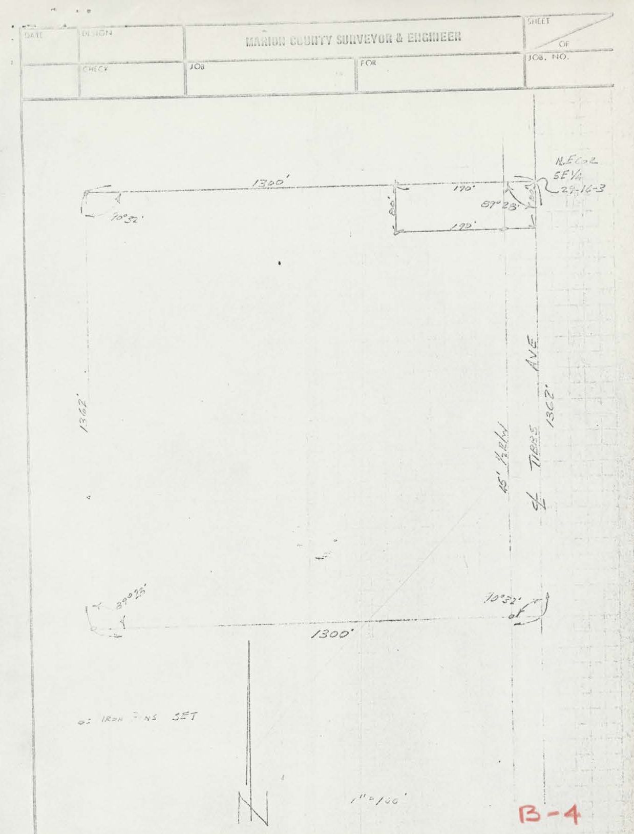
Marion County Surveryor and Engineer
A part of the Southeast quarter...
From Richard Wetzel, December 31, 1969
Operation Breakthrough Prototype, Boundary Survey
Airspace Easement. August 26, 1968
Surveyor's Description, Parcel No.1, Stamped 42614
Suveyor's Description, Parcel No.1, Stamped 42613
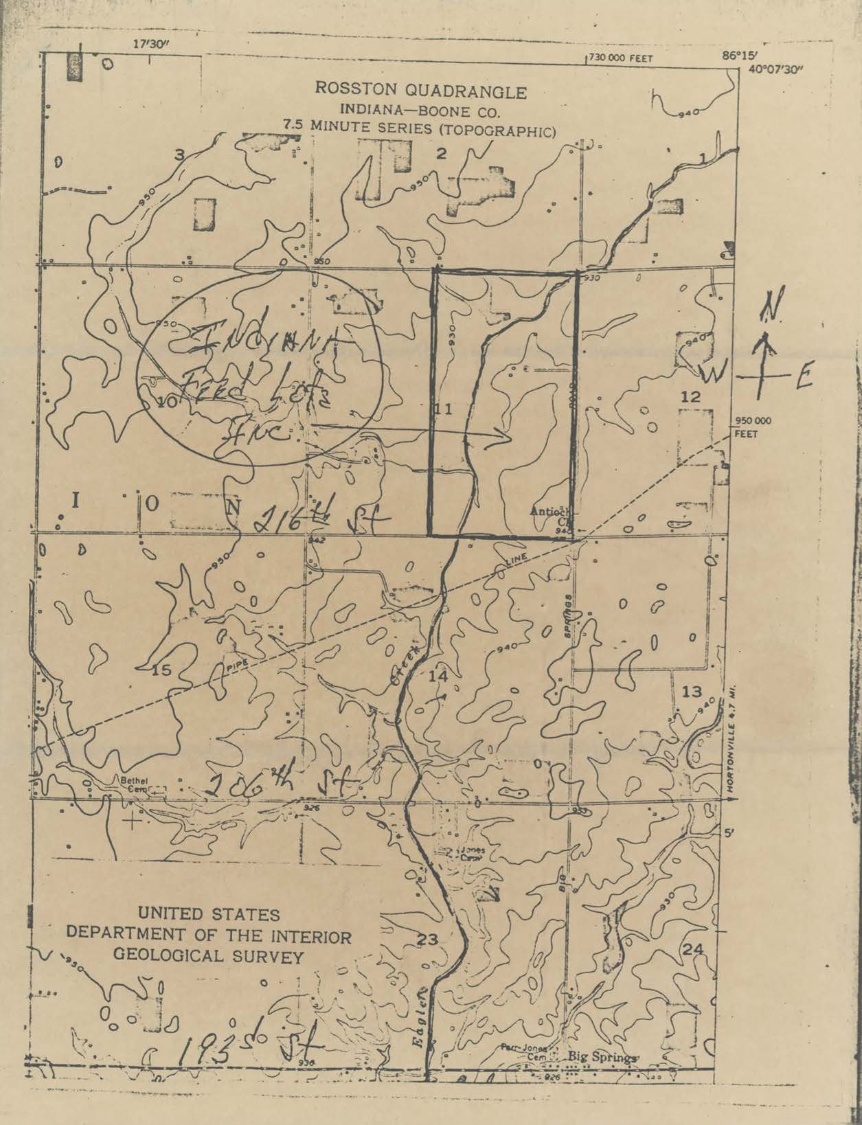
Rosston Quadrangle Geological Survey
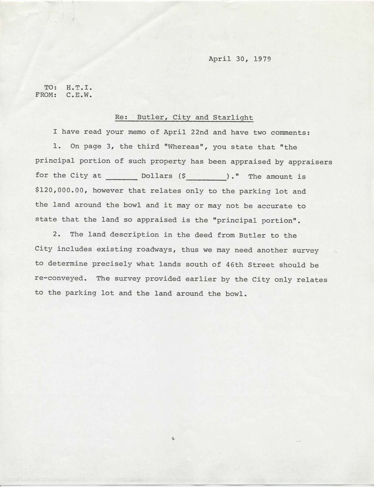
Charles E. Wilson to Harry T. Ice, April 30, 1979
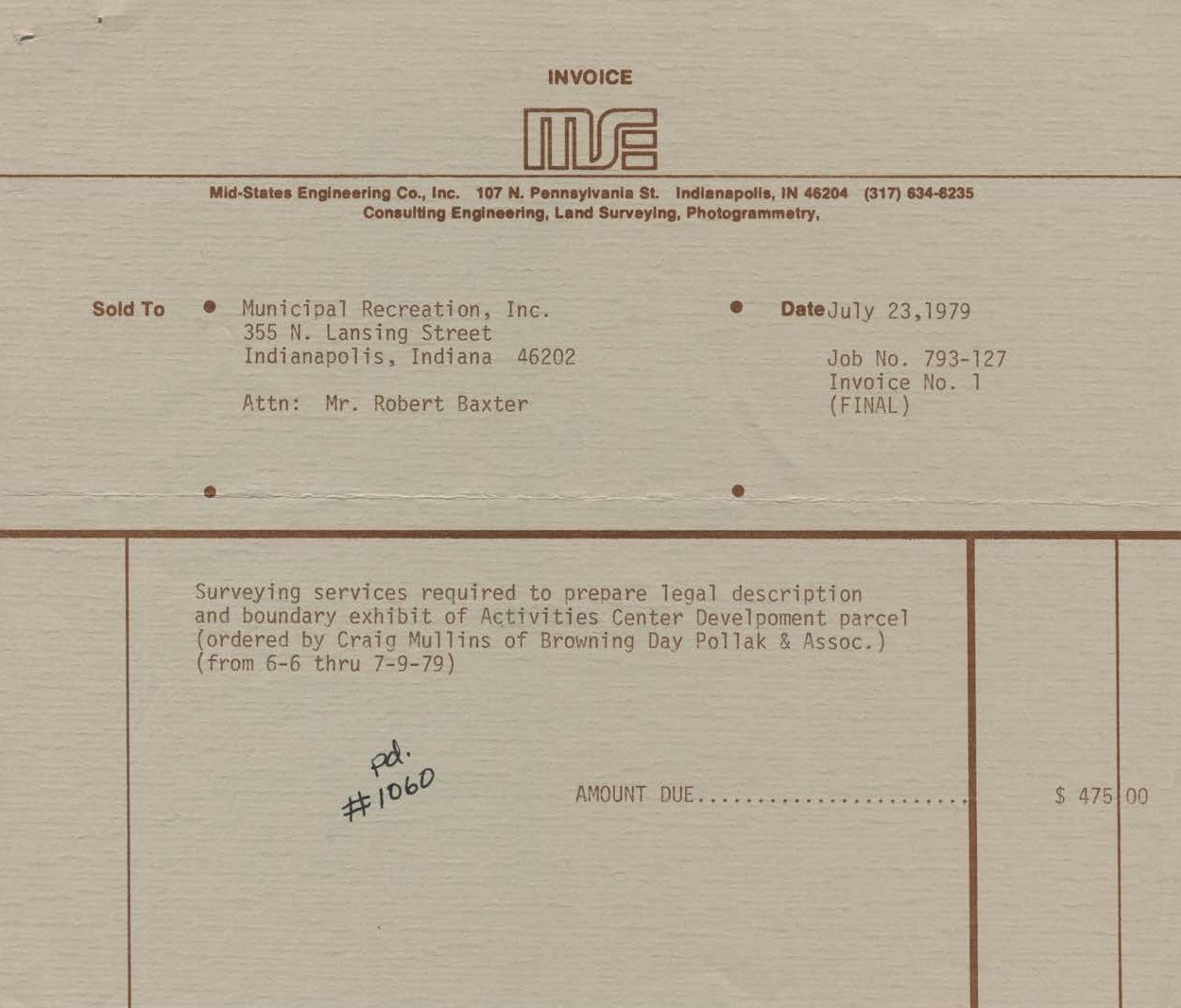
Mid-States Engineering Invoice No. 1, Job No. 793-127
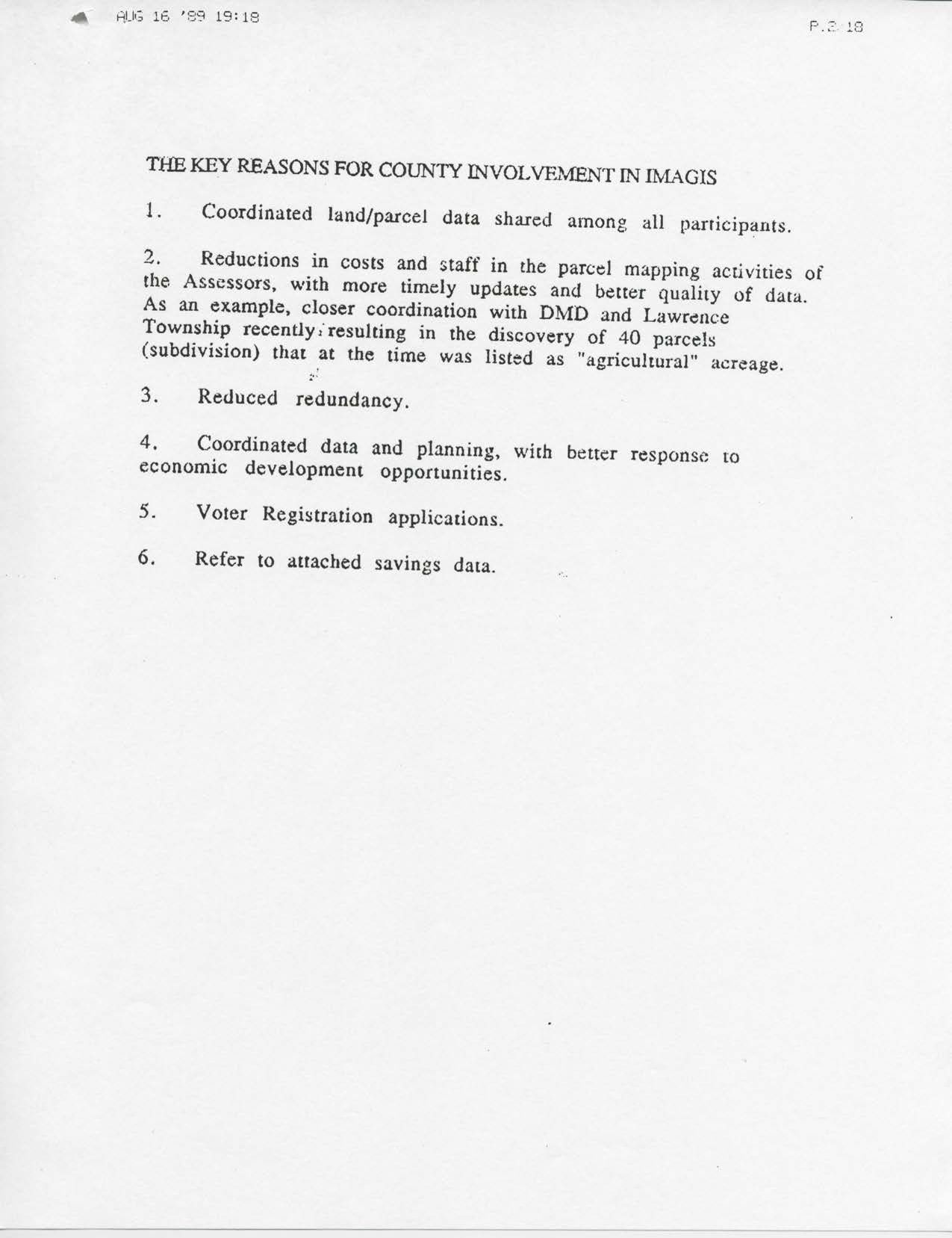
The Key Reasons for County Involvement in IMAGIS
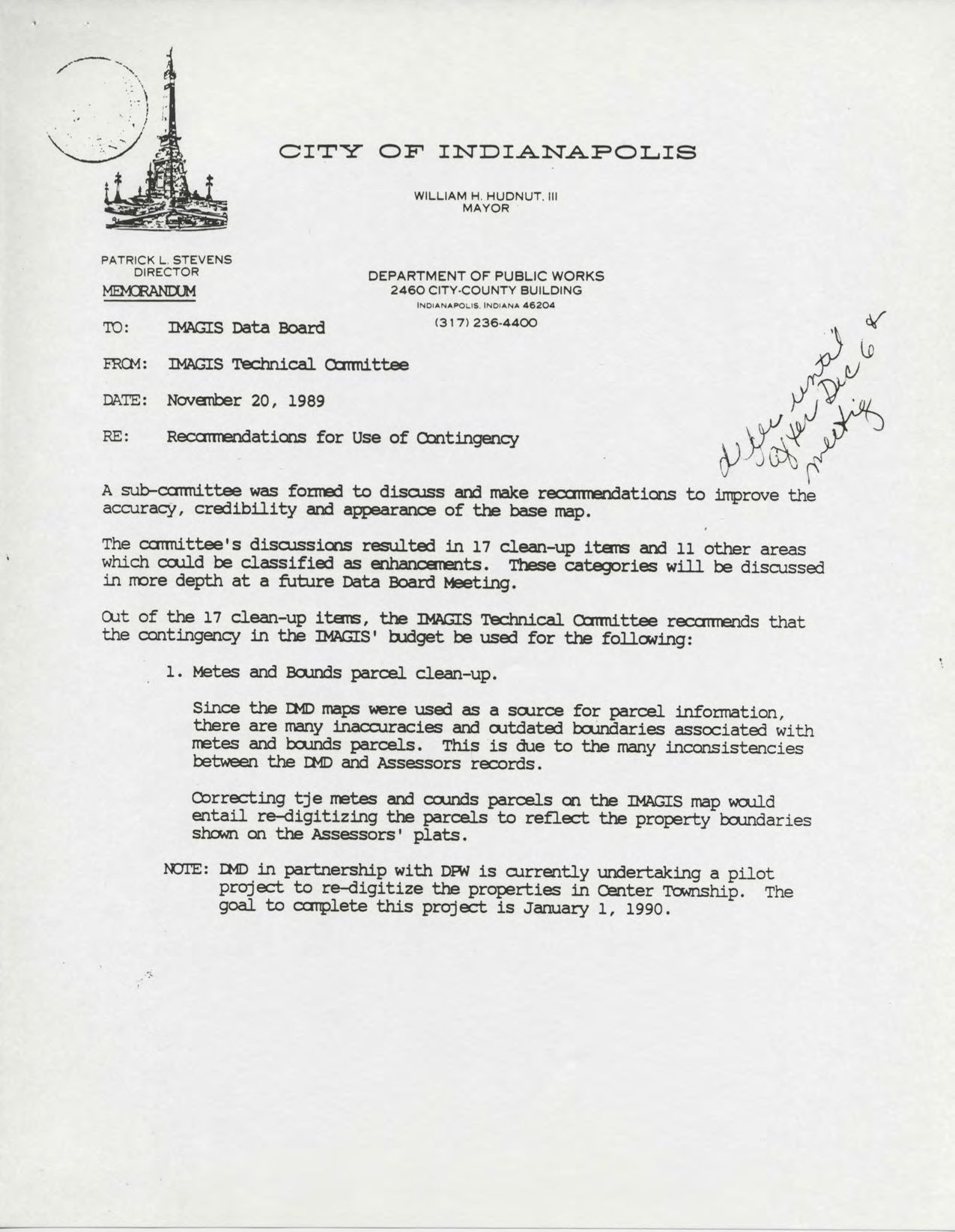
November 20, 1989 Re: Recommendations for Use of Contingency
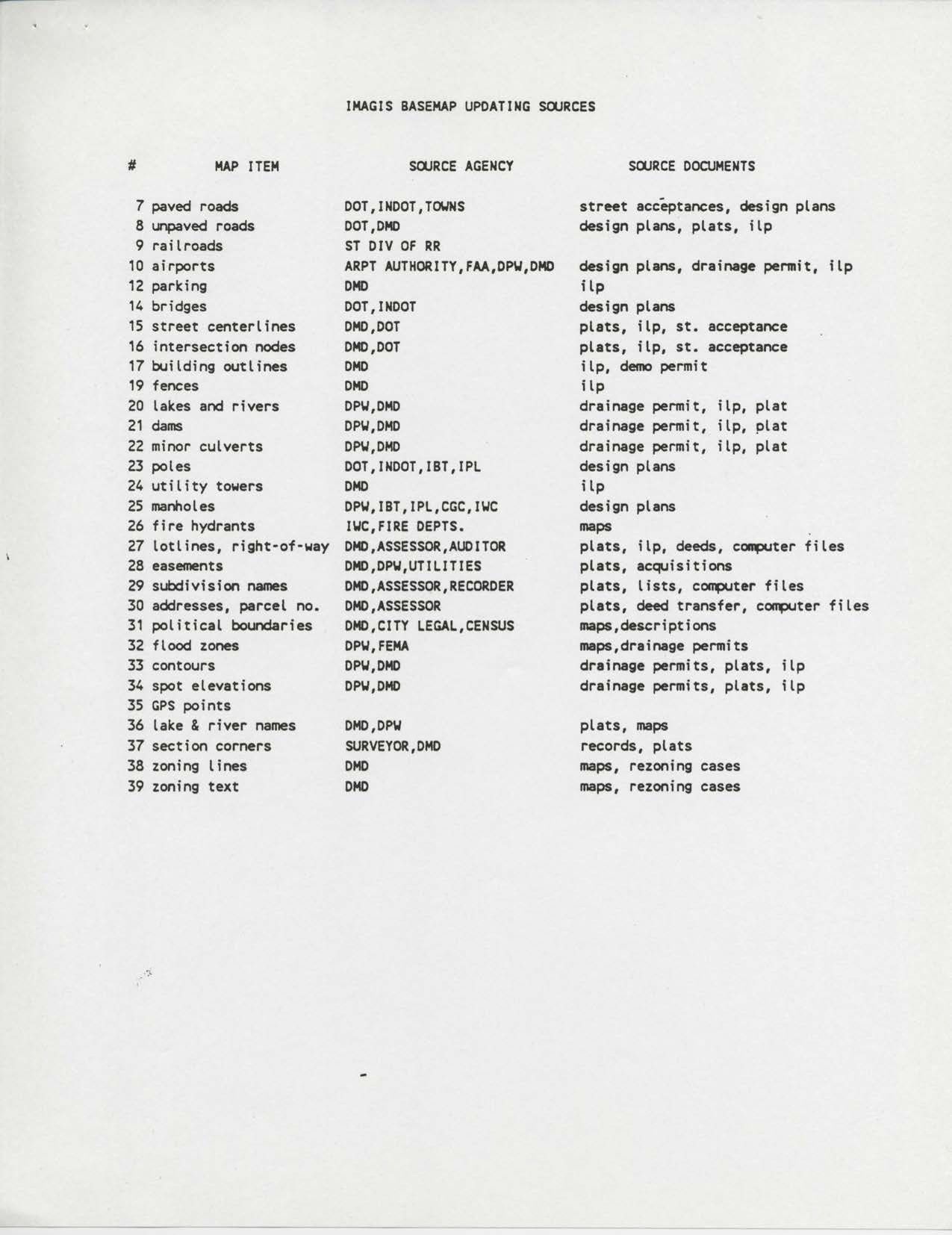
IMAGIS Basemap Updating Sources
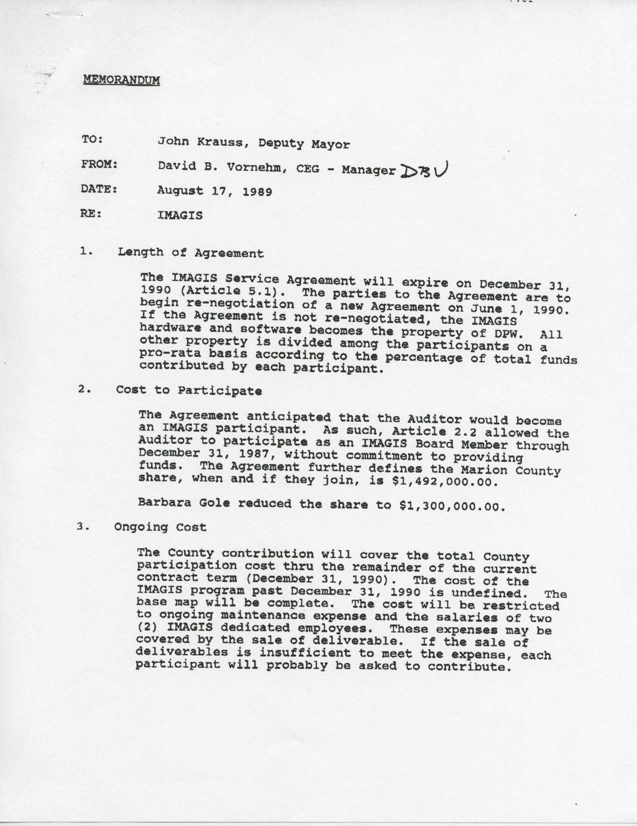
David B. Vornehm to John Krauss, August 17, 1989
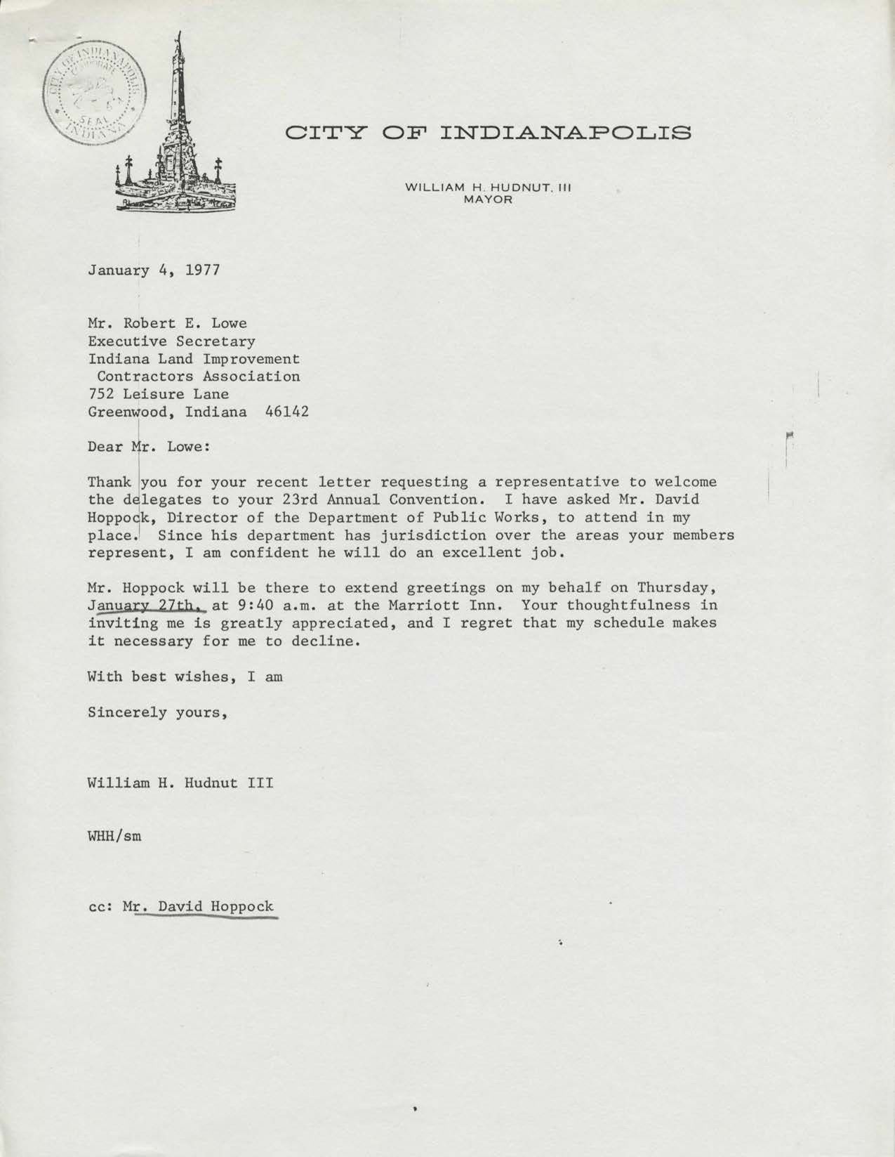
Mayor Hudnut to Robert E. Lowe, January 4, 1977
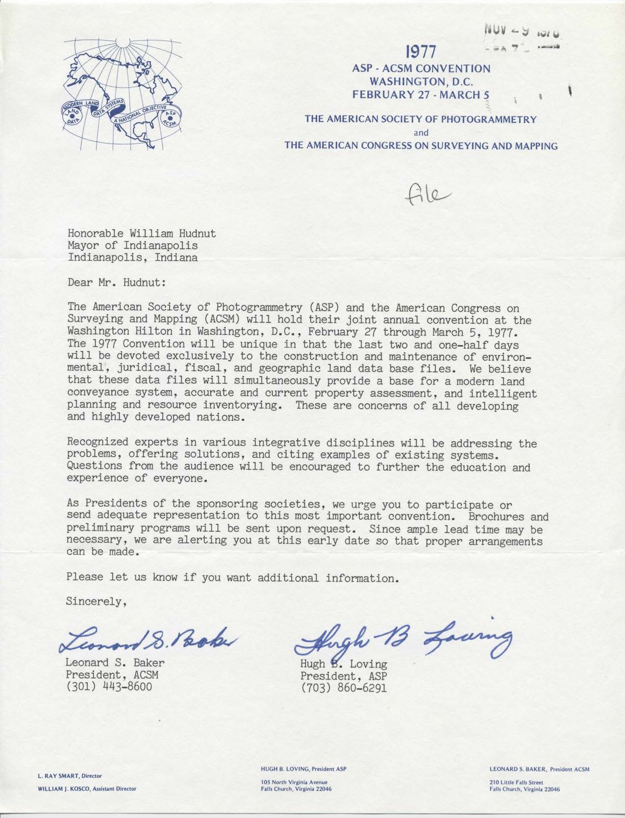
Leonard Baker and Hugh Loving to Mayor Hudnut
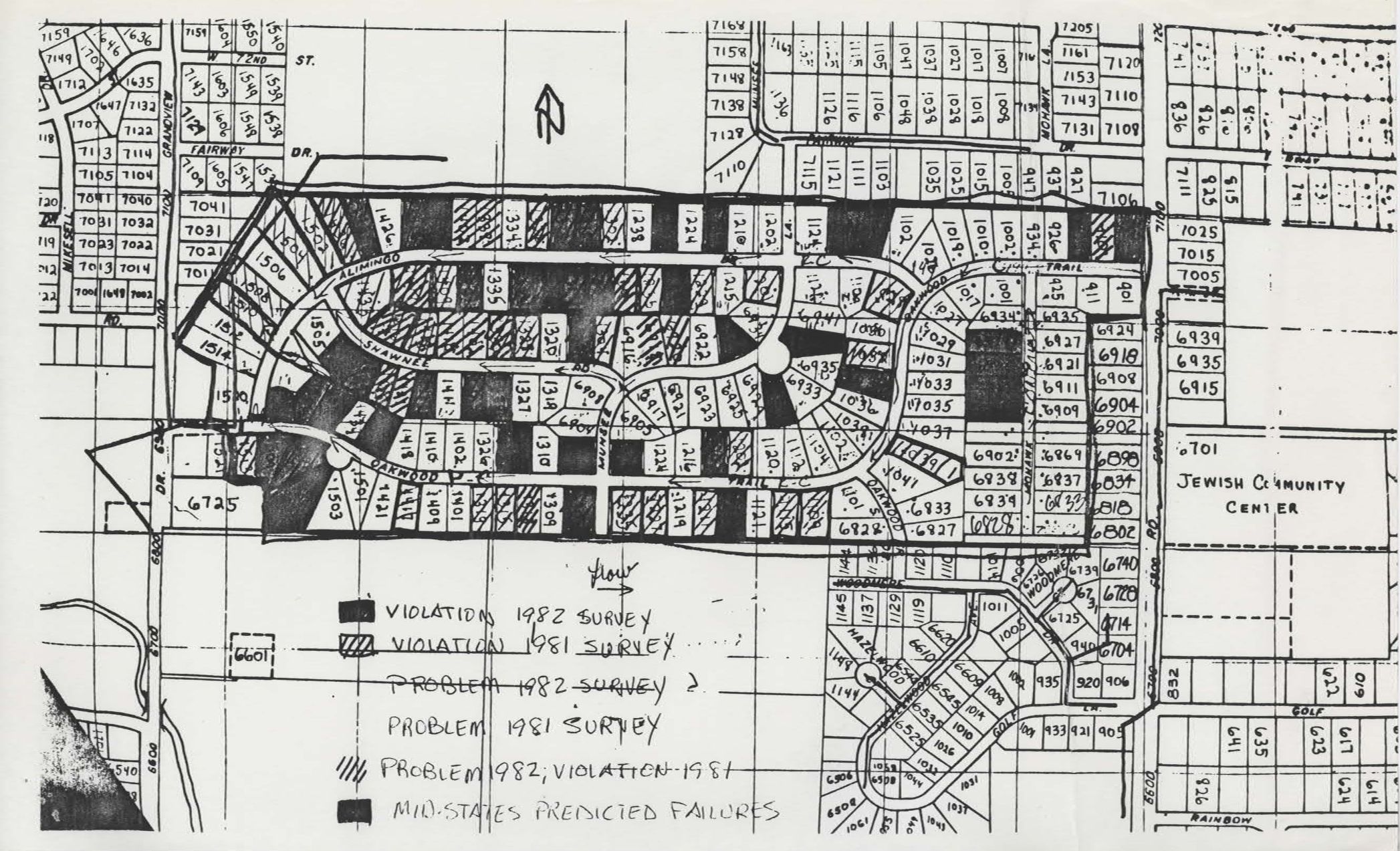
Violation and Problem Map
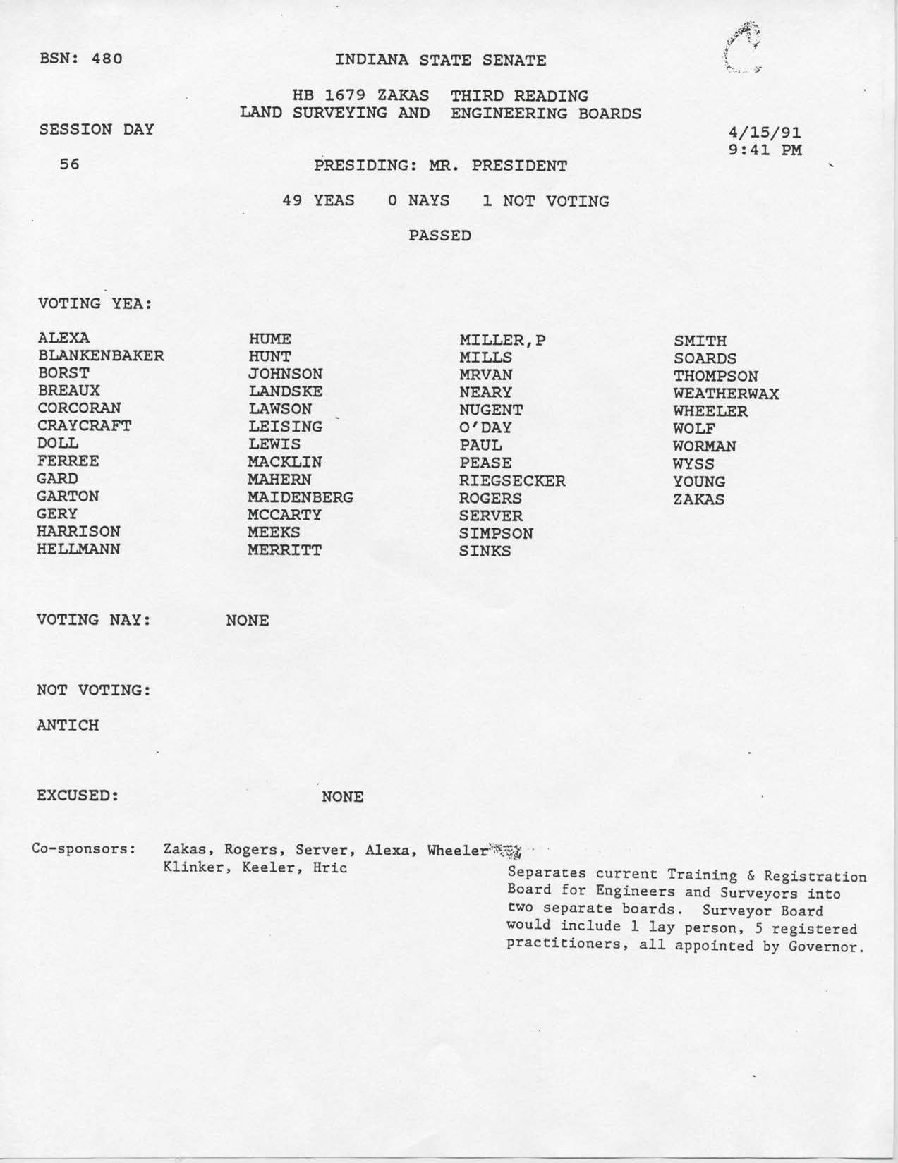
BSN: 480